There are no comments on this post yet
Ships linked to most regular oil pollution at sea
5
0
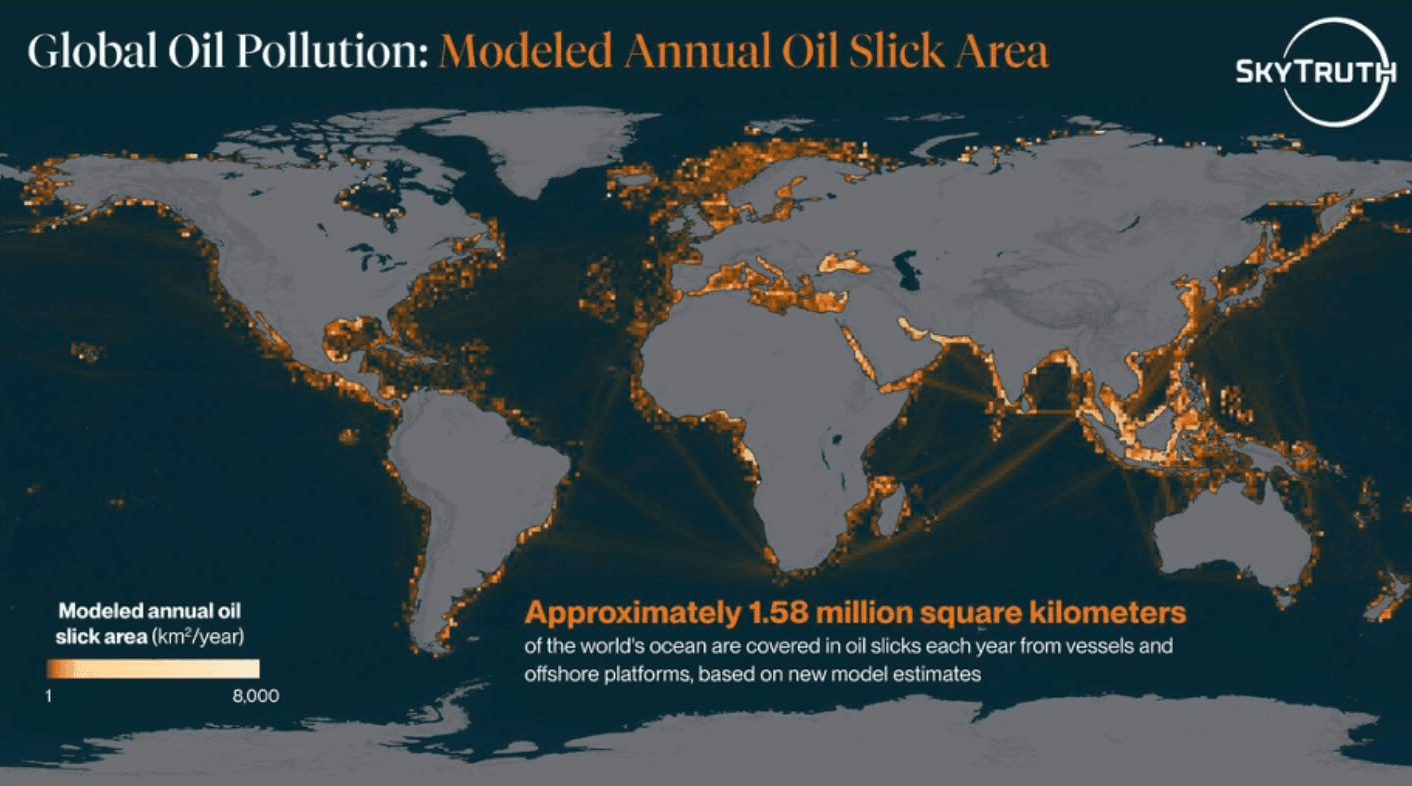
Ships are connected to most of the oil pollution regularly seen at sea, according to a new analysis by SkyTruth. Researchers estimate that oil slicks cover about 1.58 million sq km of ocean each year. They studied satellite images from 2023 to 2025 and found that vessels were linked to about 81% of the oil slick area where a source could be identified. The figure includes both AIS-tracked and dark vessels, Splash 247 reported.
The study covered both normal vessels tracked by AIS and “dark vessels” that do not show their position. Cargo ships and tankers were the main ship types linked to the pollution. Major problem areas include the Red Sea, Persian Gulf, Mediterranean and Black Sea, waters near West Africa and Indonesia.
SkyTruth also found that some ship flags appeared more often in pollution records than expected from the size of their fleets. The analysis named Palau, Panama, Malta, Comoros, Cyprus and the Bahamas among them. Researchers also identified 16 vessels that were repeatedly linked to oil slicks in satellite observations.
The real scale of the problem may be larger, the report says. Satellite coverage is limited over much of the open ocean, and ownership details were missing for more than half of the vessels linked to pollution. This makes it harder to identify those responsible for long-term oil pollution at sea.
Picture: SkyTruth, 2026
0
0